In 1980, a young photographer by the name of Gary Freeburg struck out for Alaska to teach photography at Islands Community College, in Sitka, where he also photographed for the Southeast Alaska Salmon Aquaculture Association and the National Park Service. In addition to having an MFA in photography, Freeburg had studied with renowned photographers Ansel Adams, Oliver Gagliani, and John Schultz. His aspirations at the time were modest: to be able to live in Alaska and follow opportunities and whims for taking pictures. Having previously done a stint in Vietnam, Freeburg was seeking peace and beauty, and Alaska was the place.
There, he came in contact with National Park Service Superintendent, Ernest Suazo, who had seen Freeburg’s photographs on exhibition in Sitka. Suazo suggested that Freeburg check out
The Valley of 10,000 Smokes, a desolate region about 100 miles west of Kodiak, on the Alaska Peninsula. What he didn’t tell him is that the Valley’s remoteness makes it one of the least visited of the 401 parks in the national system.
The region was formed over three to four days, beginning June 6, 1912, when a massive volcano erupted along the Alaska Peninsula. The three-day eruption was so intense that more than 5 cubic miles of ash and debris flew more than 100,000 feet into the air. Heavier deposits filled the forty-four-square-mile valley below to depths of up to 1,000 feet. Anything that may have been alive within that 44 sq. mile area was turned to ash by the hot explosions and waves of magmatic spray. This base of hot igneous material, after mixing with water, produced tens of thousands of steam vents called fumaroles. It turned out to be the largest eruption of the twentieth century and the fourth largest in history. As forbidding as it was, Freeburg found his calling in the surrounding geography. He describes his first experience as “otherworldly.” Save scientists and volcanologists, few people dare venture far into the tortuous land.
Making photographs of two key volcanic regions in Alaska has become the life work of Freeburg, now sixty-seven. Freeburg has traveled to The Valley of 10,000 Smokes five times and to the
Aniakchak Volcano, about 120 miles away, twice. When I asked Freeburg to describe the environment there he responded: “Even on a good day, it can be brutal. The air in that area turns to clouds, and 35-mph winds of blowing pumice cuts into your face like hail. It’s definitely dangerous, not just from the extreme elements, but from the many Kodiak bears who call these areas home.”
Besides his tent, food, 12-gauge shotgun, GPS, and a bear fence to surround his tent at night, Freeburg uses a Fuji 6cm x 9cm roll film camera. “There is just too much volcanic dust to bring a 4 x 5 view camera.”
++++

Main Crater Floor, Aniakchak Volcano

A stationary fog bank on the northeastern flank of Broken Mountain, Valley of 10,000 Smokes
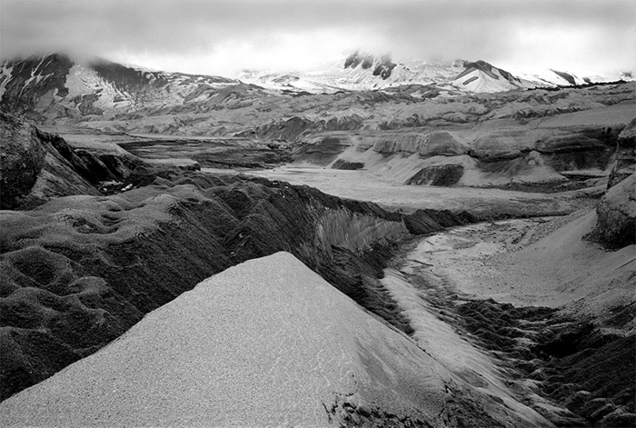
An ash-covered glacier and snowfield in a Knife Creek tributary, Valley of 10,000 Smokes
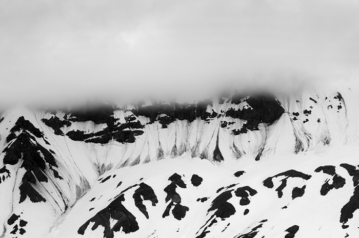
Avalanche Sweeps and Descending Fog, Southeast Crater Rim of Aniakchak Volcano
Cloud Formation over East Rim Aniakchak II
Erratic Boulder in Katmai Pass, Valley of 10,000 Smokes, Alaska
Lava Flow Melting Snowfield with Puff Cones in the Background, Aniakchak Volcano
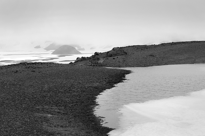
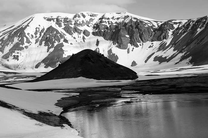
Melting Snowfield, Surprise Cone, Aniakchak Volcano
Puff Cone in Shadow, Surprise Lake in Foreground, Northwest Crater Rim in Background, Aniakchak Volcano
Southwest Maar with Ice Flows, Aniakchak Volcano
The Gates, Eastern Crater Rim of Aniakchak Volcano
Whispy Clouds over Surprise Cone, Aniakchak Volcano
Wind Cloud over Vent Mt, Aniakchak Volcano
Windblown Snowbank near Bolshoi Dome, Aniakchak Volcano







.jpg)


.jpg)


 John Foster and his wife, Teenuh, have been longtime collectors of self-taught art and vernacular photography. Their collection of anonymous, found snapshots has toured the country for five years and has been featured in Harper’s, Newsweek Online and others.